Located in the heart of the North Island, Tongariro National Park is known for two things: the awesome ski slopes on Mount Ruapehu and its picturesque hikes.
Whether you’re in the area just for the day or staying for a long weekend, you should definitely aim to tick off one of these spectacular day hikes.
Tongariro Alpine Crossing
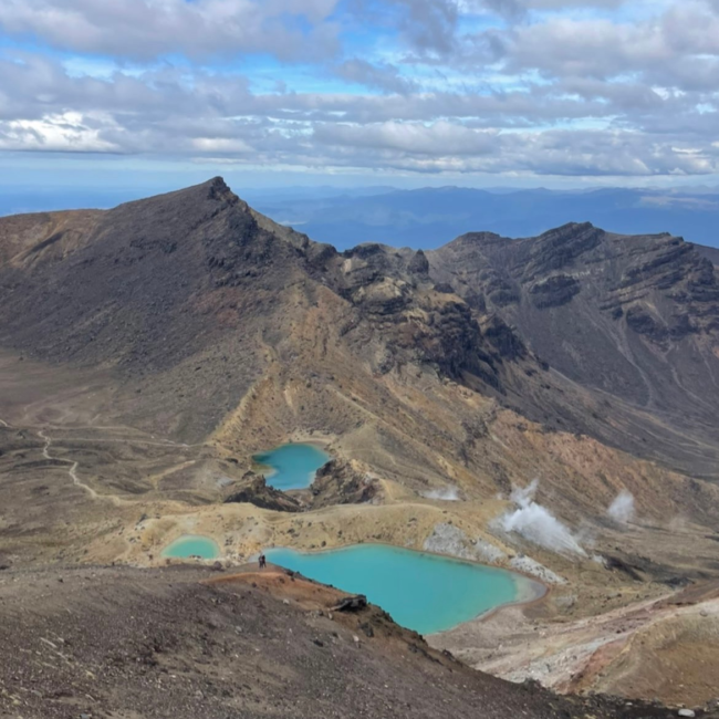
This hike is quite possibly my favourite hike in New Zealand. Due to the dramatic contrasts of desolate deserts, crater lakes, impressive mountains and active volcanoes, you can experience all the best aspects of New Zealand within 7 hours.
Commonly known as the ‘World’s Greatest Day Hike’, this point-to-point crossing is one for the bucket list. There are however a few things to know before tackling it.
The car park at the beginning has a 4-hour limit (starting from 6am) so you will need to organise transport. Fortunately, there are a few shuttle companies in the area that will drop you off at Mangetepopo Car park and pick you up at the end point, Ketetahi Car Park. Another option would be to hitch hike which is what I did one time. It is a very popular stretch of road for hitch hikers since you either head south to National Park Village or north to Turangi.
The hike itself is challenging and should only be completed if you are physically fit. Over 1200m of elevation, you will witness some incredible sights including an optional side trip to the famous Lord of the Rings landmark Mount Ngauruhoe (aka Mount Doom). It is a long hike so take plenty of food and water. The climate is constantly changing too so I would recommend wearing lots of layers since it is known to get windy and the chill is very icy. Once you reach the summit, the rest of the hike is reasonably easy with a few undulating sections. I’d also advise bringing walking poles because they’ll not only aid you getting up the steeper parts of the hike but will take some strain off your knees as you descend.
Distance: 20.2km
Duration: 6-8 hours
Elevation: 1196m
Type of hike: Point-to-point
Taranaki Falls
Starting from New Zealand’s highest hotel, Skotel Alpine Resort, Taranaki Falls showcases incredible mountain views and an impressive waterfall popular for swimming. The lower track begins through shrublands then swiftly leads you into the woods. Completing the track this way round provides more shelter from the wind and sun. Soon enough the roar of the falls will be heard as the water echoes off the cliff and tumbles 20 metres into a plunge pool. The water is so refreshing you’ll be itching for a swim to cool off. Mount Ruapehu erupted 15,000 years ago and created a lava flow which is now Taranaki Falls. The track proceeds through a forest up a flight of steps. Once you reach the clearing, you can continue onwards to Tama Lakes or turn right to Whakapapa. On a clear day Mount Ngauruhoe is visible and it is a great place to really appreciate the size of this stratovolcano.
The most intense part of this hike is climbing the steps but it is generally a very tame hike. It can be done in trainers but I would still recommend walking boots. Apart from the wooded areas, there isn’t much shade either so you should also be prepared with lots of water. As mentioned, there is the option to go for a swim in the falls so don’t forget to bring your swimsuit.
Distance: 6km
Duration: 1.5 hours
Elevation: 145m
Type of hike: Circular Trail
Tama Lakes
This is a shorter less demanding option to see some of Mother Nature’s finest work without having to do the Tongariro Crossing. An extension of Taranaki Falls, Tama Lakes was created around 10,000 years ago during an eruption by several explosion craters. There still remains blocks of lava and ash from the Mount Ruapehu explosion in 1996.
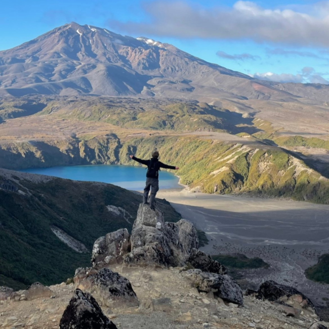
From Taranaki Falls, you continue along a well-maintained path across boardwalks and through tussock fields until you reach the lower lake. From here, it’s a steep climb to the viewpoint of both lakes and where the weather can quickly change. The climb requires a scramble up loose rock and scree to get to the top which is when hiking poles are quite useful. Once you reach the saddle, it can be very windy but the views are breath taking. On a clear day you can see both lakes as well as Mt Ngauruhoe and Mt Ruapehu.
To avoid any dangers due to the constantly changing climate, prepare yourself with warm, waterproof clothing.
Distance: 17.6km
Duration: 5-6 hours
Elevation: 527m
Type of hike: Out and back
Silica Rapids
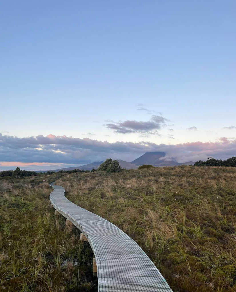
This track follows the meandering Whakapapnui stream through a beech forest. Shortly you’ll enter a field of tussock and marshland with a boardwalk which prevents you from damaging the vegetation underneath. For the majority of the hike, you can hear the rapids bubbling alongside you. You’ll realise the colour of the river has a yellow/gold undertone due to the iron deposits and high saturation of aluminium. Along the boardwalk, you can look out on the vast expanse of the surrounding mountains including Mount Ruapehu. Continue to the rapids and you’ll pass native ferns, rocky landscapes, dense bush and lava formations. You can return via the same path or continue along Bruce Road to loop back to the start.
The hike is very simple and can be completed in trainers. You begin the hike in Whakapapa village above the visitor centre.
Distance: 7km
Duration: 1 hour 45 mins
Elevation: 180m
Type of hike: Out and back
Tawhai falls
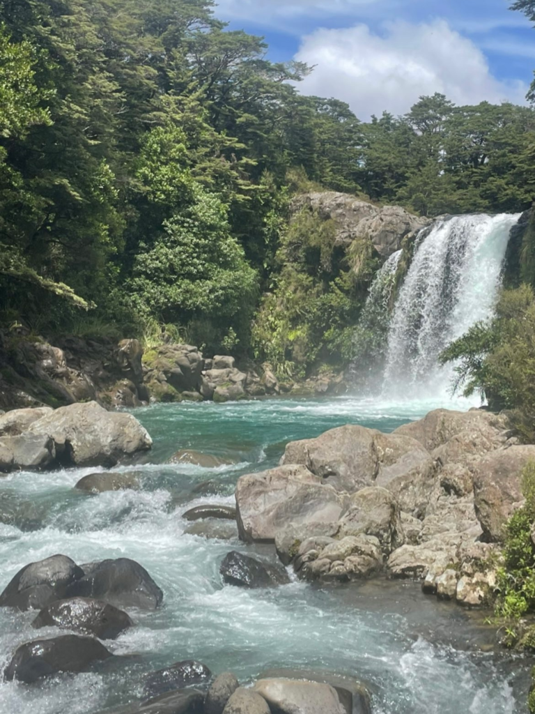
This is a very easy hike that can be completed by all ages. It is a short walk through a forest to the falls which is a very popular spot for a quick, refreshing dip. The cascading water is very powerful so be careful if you do decide to go for a swim. Although the waterfall isn’t the most impressive of sizes, the mesmerising, cerulean blue water makes up for it.
This waterfall is also known as ‘Gollum’s Pool’ since it featured in Lord of the Rings as the ‘forbidden pool’ where Frodo and Faramir captured Gollum.
Distance: 600m
Duration: 20 minutes
Elevation: 22m
Type of hike: Out and back